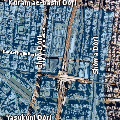
File originale(file in formato SVG, dimensioni nominali 1 280 × 1 280 pixel, dimensione del file: 2,64 MB)

Logo di Commons
Logo di Commons
Questo file e la sua pagina di descrizione (discussione · modifica) si trovano su Wikimedia Commons (?)

Dettagli

Descrizione
English: Shop areas of Akihabara defined by akibamap.net.

Although unofficial area definitions, it is useful to locate small shops, because operational district of Akihabara is very complicated.

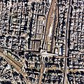
  • original file: An aerial photograph near JR Akihabara Station in 1989.
Note: Before editing this SVG file, you should download File:1989 Akihabara.jpg in the same folder.
Data
Fonte http://nrb-www.mlit.go.jp/Air/photo400/89/ckt-89-3/c5/ckt-89-3_c5_32.jpg (WebGIS2.0 (ckt-84-3,#32))
Autore Ministry of Land, Infrastructure, Transport and Tourism, Japan
Licenza
(Riusare questo file)
© Il detentore del copyright di questo file, the Ministry of Land, Infrastructure, Transport and Tourism of Japan, permette a chiunque di utilizzarlo per qualsiasi scopo, a condizione che il detentore del copyright venga riconosciuto come tale. Sono consentiti la redistribuzione, le opere derivate, la modifica, l'uso commerciale ed ogni altro uso.
Attribuzione:
Copyright © National Land Image Information (Color Aerial Photographs), Ministry of Land, Infrastructure, Transport and Tourism

Notice
This image is copyrighted by the Ministry of Land, Infrastructure, Transport and Tourism of Japan. For terms of use, see the stipulation to use of National Land Information (in Japanese) and message from MLIT (in Japanese and English). When you display this image on an article, include the following phrase in the description: "Made based on National Land Image Information (Color Aerial Photographs), Ministry of Land, Infrastructure, Transport and Tourism".
Altre versioni

Didascalie

Aggiungi una brevissima spiegazione di ciò che questo file rappresenta

Elementi ritratti in questo file

raffigura

image/svg+xml

8c512b52e6ef249042c82ac4012ec56041361456

2 769 963 byte

1 280 pixel

1 280 pixel

Cronologia del file

Fare clic su un gruppo data/ora per vedere il file come si presentava nel momento indicato.

Data/OraMiniaturaDimensioniUtenteCommento
attuale18:32, 4 lug 2010Miniatura della versione delle 18:32, 4 lug 20101 280 × 1 280 (2,64 MB)DieBucheembedd
15:31, 30 giu 2010Miniatura della versione delle 15:31, 30 giu 20101 280 × 1 280 (14 KB)DieBucheTry to fix SVG using scour
02:58, 12 apr 2010Miniatura della versione delle 02:58, 12 apr 20101 280 × 1 280 (30 KB)ChimeFix image reference: 1. updated for latest File:Akibamap 1.jpg / 2. added "xml:base" attribute for compatibility (File:1989 Akihabara.jpg) / 3. changed "sodipodi:absref" attribute for compatibility (File:1989 Akihabara.jpg) / Note: Before editing t
12:00, 3 mar 2010Miniatura della versione delle 12:00, 3 mar 20101 280 × 1 280 (24 KB)Chimecorrect Image URL to raw image URL on Wikimedia Commons.
11:43, 3 mar 2010Miniatura della versione delle 11:43, 3 mar 20101 280 × 1 280 (24 KB)Chimecorrect image reference. (But, it may be not work on all platform due to mis-implementation of SVG engines. For example, Inkspace covert URL to local cache reference... Oh my implementer!)
10:46, 3 mar 2010Miniatura della versione delle 10:46, 3 mar 20101 280 × 1 280 (24 KB)Chime{{Information |Description={{en|1=Shop areas of Akihabara defined by [http://www.akibamap.net/ akibamap.net]. Although unofficial area definitions, it is useful to locate small shops, because operational district of Akihabara is very complicated. origin

La seguente pagina usa questo file: